GIS
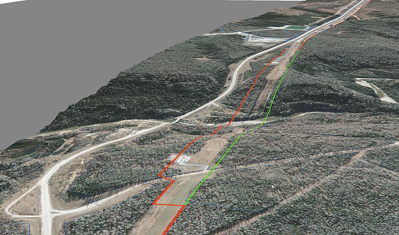
Global Raymac’s team of highly trained specialists provide leading-edge GIS solution and mapping services for projects of all sizes in British Columbia, Alberta, and Saskatchewan. We give our clients the power to visualize their data by collecting, organizing, analyzing, and displaying it in a customized way unique to the project needs.
With experience in every industry, we can easily assess your individual requirements and develop an effective GIS mapping solution. Global Raymac’s GIS technology, tools, and capabilities allow us to help our clients plan and monitor their project throughout its lifecycle.
We have created custom GIS solution and mapping services for these projects:
-
Hydrography
-
Transportation layers
-
Wellsites, pipelines, and facilities
-
Crown dispositions
-
Orthophotos
-
LiDAR hillshades
-
Change/progress detection
-
Well & pad optimized design
-
Drainage analysis
-
Data collection
-
Spatial analysis
-
Spatial optimization
-
Cut/fill
-
Drainage/hydrology
-
Pile/pit volumes
-
Public engagement
-
Crowdsourcing
-
Asset management
-
Field data collector apps
-
Field conditions assessments
-
Wayfinding
-
BIM building information modeling
-
Project data management
-
Integrated site plans
-
Land use maps

Global Raymac's Web Portal
The central GIS group is at the forefront of digital transformation at Global Raymac.
The use of Amazon Web Services for secure cloud computing, processing, database, and storage activities allows us to provide our clients with their own dedicated GIS web map or their own GIS web portal. This way you can access web maps, progress dashboards, 3D scenes, 360 viewing tools, and documents in a secure environment. Our automation workflows extend our systems by performing the synchronization of approved data of all kinds, ensuring data content is up to date and accessible for web delivery.
